
Editor's Note: This is one of several open-source intelligence (OSINT) investigations conducted by the NAWA Media Open-Source Investigations Team in collaboration with journalists at The Public Source. These reports were produced in October and November of last year; due to the rapidly escalating violence, the figures are a historical record of that time rather than a reflection of the current reality. Through these reports, we aim to contribute to the growing body of evidence of war crimes and crimes against humanity committed by Israel in its war against the Palestinian people in Gaza. For this reason, the authors of these investigations use precise and cautious language that helps in advancing the prosecution of these crimes in international courts.
Photos and videos published on social media and news websites on the day of the attack and the following three days were collected, preserved, and analyzed. Thirty two different media sources were used in the investigation.
The date and time of the attack were determined using X’s (formerly Twitter) advanced search and InVID, an open-source tool that extracts media date and time through video fragmentation and reverse image search. We used these data to confirm the local time of the first post about the attack. SunCalc, an open-source tool that determines the time photos and videos were taken based on the length and direction of shadows, was also used to determine the time of images taken at the attack site. Results from SunCalc were consistent with the results of the first post published on X.
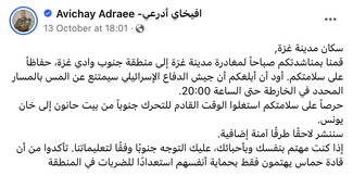
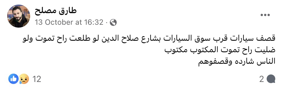
We matched photos and videos published by users on social media showing a truck with two trailers impacted by the attack, a number of bodies dumped at the site of the attack, a damaged ambulance on the side of the road on Salah al-Din Street, and several cars that appeared to be burning.
The geographical location on Salah al-Din Street was determined by searching for Salah al-Din Street, Street No. 10, and Gaza Valley Bridge on OpenStreetMap which contains more accurate data of the names of local areas than Google Maps and Google Earth. We then specified a search range of 4.6 km around the area of attack, pinpointed distinctive visual identifiers such as shops that appeared in the photos and videos, and compared them to satellite images.
We determined who is likely responsible for the attack based on an analysis of the trajectory of the munition and their penetration angles in the cars. We used the location of the damage and evidence of its impact, the location of the cars in Salah al-Din Street near the Kuwait Roundabout, and information on who was in control of the area.
This investigation is the result of multiple stages of analysis of available open-source information of the date, time, and location of the incident, as well as information on the munitions allegedly used and the party allegedly responsible for the attacks and the resulting damage. Through examining all available information about the attacks, this investigation provides an understanding of the incident as well as the alleged perpetrators.






Share this page